Project Profile
Strategic Conservation Assessment (SCA) of Gulf Coast Landscapes
Researchers: Kristine Evans, Ethan Liang
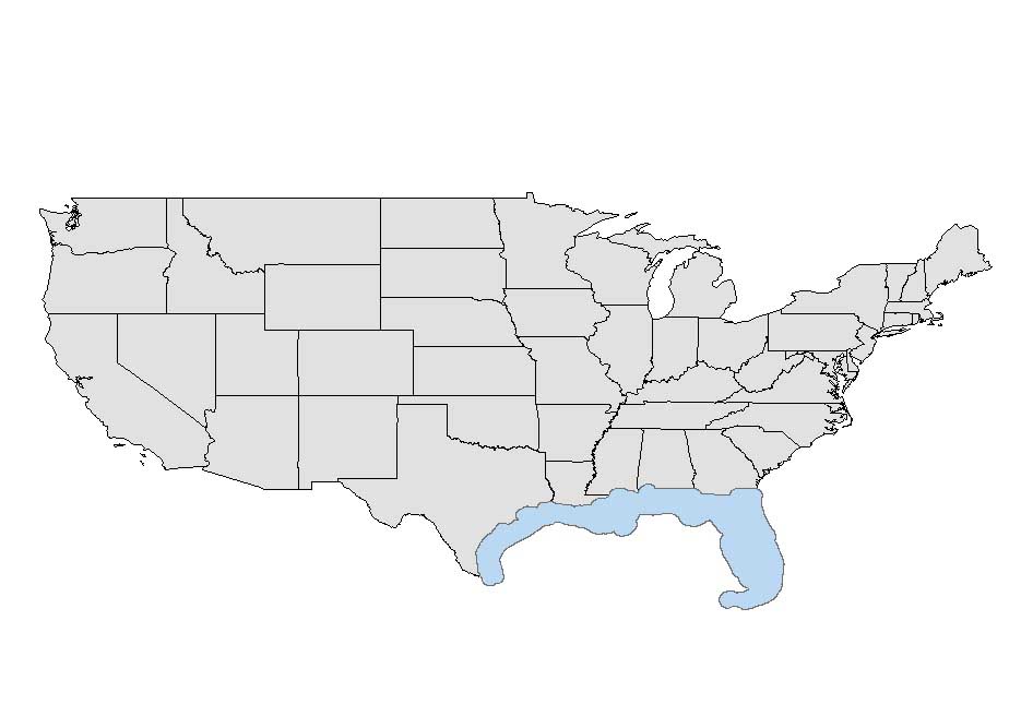
Location: The SCA region of interest aligns with the RESTORE Act-identified Gulf Coast Region (GCR), an area of approximately 700,000 km2. The GCR encompasses coastal parts of Alabama (AL), Louisiana (LA), Mississippi (MS), Texas (TX), and all of Florida (FL).
Project Narrative
In response to the Deepwater Horizon Oil Spill in 2010, the United States government authorized the Resources and Ecosystems Sustainability, Tourist Opportunities and Revived Economies of the Gulf Coast States Act (RESTORE Act) in order to develop and implement a comprehensive strategy for restoration and protection of the Gulf Coast Region (GCR) of the United States. The RESTORE Act established the Gulf Coast Ecosystem Restoration Council (RESTORE Council), which is responsible for implementing protection and restoration of the GCR as described by their initial comprehensive plan. The Strategic Conservation Assessment of Gulf Coast Landscapes (SCA) Project, funded under the RESTORE Council's council-selected restoration component (Bucket 2), is intended to: 1) collate existing plans and priorities within an ecological and socio-economic framework proposed by the RESTORE Council's initial comprehensive plan, 2) develop tools and templates that can evaluate and strengthen existing land conservation proposals, and 3) develop spatial data layers that can be used to identify potential areas for land conservation projects. To accomplish the three objectives, the SCA project is developing a suite of three tools where users can explore a catalog of existing conservation plans and projects across the GCR (Conservation Plan Inventory Tool), evaluate and strengthen conservation proposals (Conservation Prioritization Tool), and explore areas within the GCR based on conservation priorities (Conservation Visualization Tool). The SCA tool suite is available to individuals and organizations who are interested in maximizing conservation benefits across the GCR within an environmental, social, and economic context.
The SCA project has taken a collaborative approach in each stage of project development. In total, over 650 stakeholders across the five Gulf States (Texas, Louisiana, Mississippi, Alabama, and Florida) worked together to identify conservation priorities in the Gulf Coast Region, and to test and give feedback on the functionality and design of the tools. The SCA tools were adjusted to incorporate the feedback of potential users and their priorities.
The development of the SCA tools has also been guided by a Core Working Group, comprised of individuals from each of the RESTORE Council agencies. Several technical experts served on the Data Team to identify and vet the relevant data layers to be incorporated into the tools.
The Project Team includes individuals from Mississippi State University: Kristine Evans (PI), Sathish Samiappan, Ethan Liang, and Steve Ashby (retired); and MSU contractors Amanda Sesser, Jaime Lopez, Anthony Collini. Team members from Auburn University: Anna Linhoss. Team members from the US Fish & Wildlife Service include: John Tirpak, Todd Hopkins, Yvonne Allen, and Shannon Westlake.
Partners: Geosystems Research Institute, Mississippi State University
Northern Gulf Institute, Mississippi State University
Department of Agricultural and Biological Engineering, Mississippi State University
U.S. Fish and Wildlife Service
Sponsors: The SCA project is sponsored by the U.S. Department of Interior and funded via the 2015 Funded Priorities List of the Council-Selected Restoration Component via a Gulf Ecosystems Studies Unit Cooperative Agreement with the U.S. Fish and Wildlife Service.
Project Publications
- Sesser, A., S. M. Westlake, C. Schafer, J. Roberts, S. Samiappan, Y. Allen, A. Linhoss, T. Hopkins, J. Liu, A. Shamaskin, J. Tirpak, K. O. Evans. (In Review). Co-producing decision support tools for strategic conservation of Gulf Coast landscapes. Current Research in Environmental Sustainability (May 2021).
- Shamaskin, A., S. Correa, G. Street, A. Linhoss, K. Evans. (In Review). Considering the influence of land-use/land cover on estuarine biotic richness with Bayesian hierarchical models. Ecological Applications.
- Shamaskin, A., S. Samiappan, J. Liu, J. Roberts, A. Linhoss, K. Evans. (2019). Multi-attribute ecological and socioeconomic geospatial data layer for the Gulf of Mexico coastal region of the United States. Data 2020:5, 3. doi:10.3390/data5010003.
- Samiappan, S., A. Shamaskin, J. Liu, J. Roberts, A. Linhoss, K. Evans. (2019). Land conservation in the Gulf of Mexico region: a comprehensive review of plans, priorities, and efforts. Land 8:84. https://doi.org/10.3390/land8050084.


